
Featured
Strong Storms Possible on Wednesday
By Alyssa Schnugg
News editor
alyssa.schnugg@hottytoddy.com
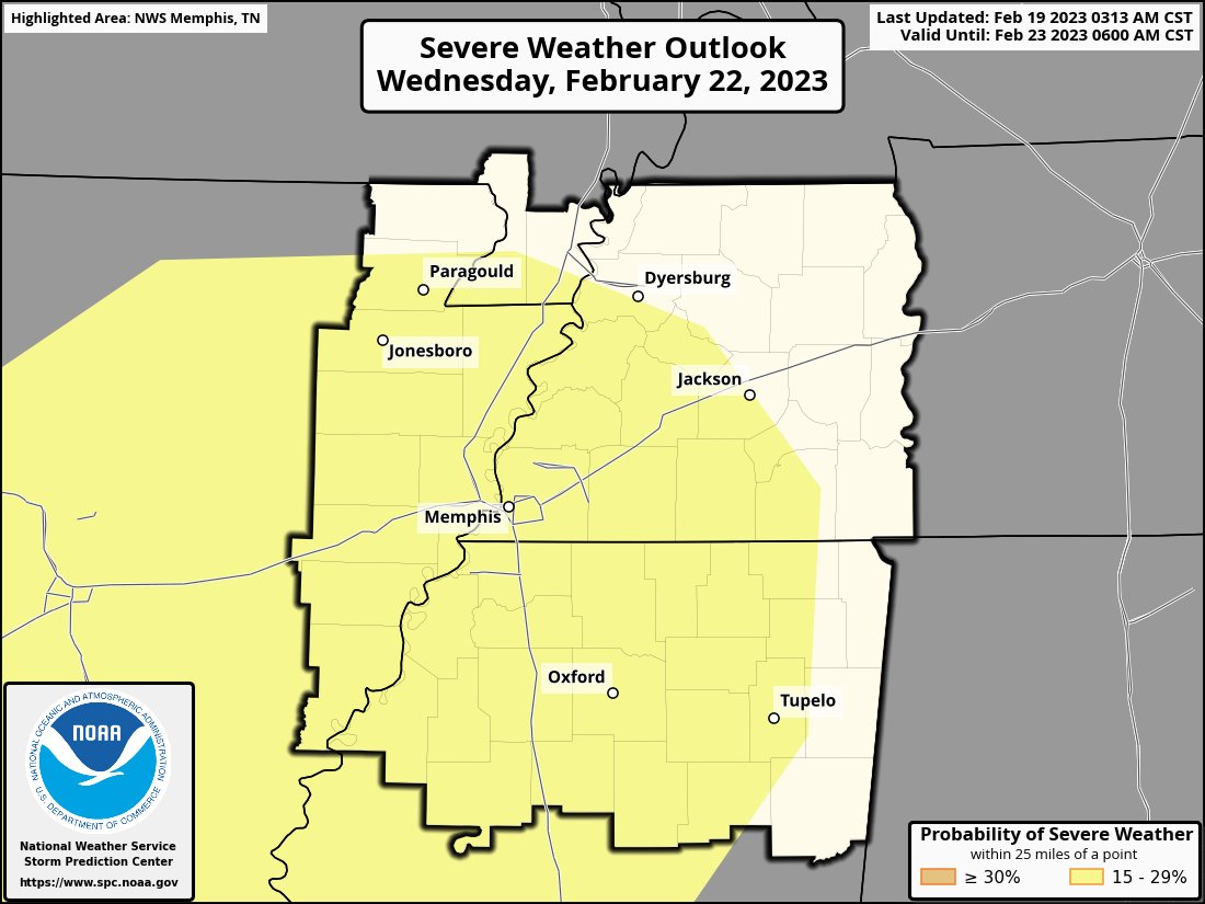
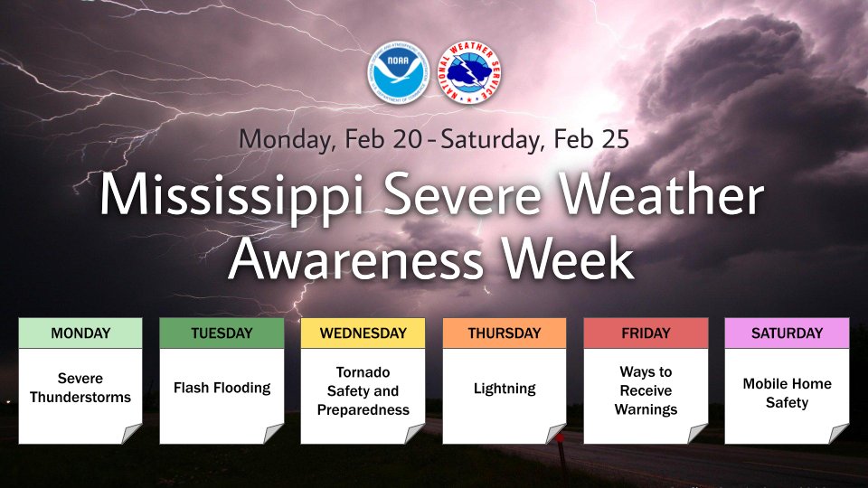
This week is Mississippi Severe Weather Awareness Week and the Mid-South may get a chance to become very aware as there is a possibility of some severe storms on Wednesday, according to the National Weather Service.
Today will be cloudy and there is a slight chance of some rain showers throughout the day. The high today should hit 70 degrees. Tonight’s low is expected to be 56 degrees. There is a chance of rain before 8 a.m. And then again after midnight.
Tuesday will be mostly cloudy with a 30 percent chance of rain before noon. The remainder of the day will be cloudy with a high near 71 degrees.
On Wednesday, most clouds will roll into the area in the afternoon, bringing a 60 percent chance of thunderstorms between noon and 3 p.m. More rain showers are likely after 3 p.m. Some of the storms could be severe. There’s a chance of wind gusts up to 40 mph.
Storms and wind are expected throughout most of Wednesday night with a low of around 55 degrees. Wind will be 10 to 15 mph and gust up to 35 mph.
The skies should clear on Thursday with a high reaching almost 80 degrees under mostly sunny skies. Winds will continue to be gusty as the front moves out of the area. There is a 30 percent chance of rain Thursday night after midnight.
There is a slight chance of rain n Friday and Saturday currently. Skies are expected to be cloudy. Friday’s high will be bear 56 degrees; however, the temperature will jump to a high of around 70 on Saturday.
Rain is expected again on Sunday.
There are currently no weather watches or warnings issued for Lafayette County. Hotty Toddy News will provide weather updates as they are available on its website, Facebook, and Twitter.

| Sat, Aug 31 |  | vs Furman | W, 76-0 |
| Sat, Sep 7 |  | vs Middle Tennessee | W, 52-3 |
| Sat, Sep 14 |  | @ Wake Forest | W, 40-6 |
| Sat, Sep 21 |  | vs Georgia Southern | W, 52-13 |
| Sat, Sep 28 |  | vs Kentucky | L, 20-17 |
| Sat, Oct 5 |  | @ South Carolina | W, 27-3 |
| Sat, Oct 12 |  | vs LSU | L, 29-26 (2 OT) |
| Sat, Oct 26 |  | vs Oklahoma | W, 26-14 |
| Sat, Nov 2 |  | @ Arkansas | W, 63-35 |
| Sat, Nov 16 |  | vs Georgia | W, 28-10 |
| Sat, Nov 23 |  | @ Florida | L, 24-17 |
| Sat, Nov 30 |  | vs Mississippi State | W, 26-14 |
| Thu, Jan 2 |  | vs Duke (Gator Bowl) | W, 52-20 |
| Mon, Nov 4 |  | vs Long Island University | W, 90-60 |
| Fri, Nov 8 |  | vs Grambling | W, 66-64 |
| Tue, Nov 12 |  | vs South Alabama | W, 64-54 |
| Sat, Nov 16 |  | vs Colorado State | W, 84-69 |
| Thu, Nov 21 |  | vs Oral Roberts | L, 100-68 |
| Thu, Nov 28 |  | vs BYU | W, 96-85 OT |
| Fri, Nov 29 |  | vs 13 Purdue | L, 80-78 |
| Tue, Dec 3 |  | @ Louisville | W, 86-63 |
| Sat, Dec 7 |  | vs Lindenwood | W, 86-53 |
| Sat, Dec 14 |  | vs Southern Miss | W, 77-46 |
| Tue, Dec 17 |  | vs Southern | W, 74-61 |
| Sat, Dec 21 |  | vs Queens University | W, 80-62 |
| Sat, Dec 28 |  | @ Memphis | L, 87-70 |
| Sat, Jan 4 |  | vs Georgia | 11:00 AM SECN |
| Wed, Jan 8 |  | @ 23 Arkansas | 6:00 PM TBA |
| Sat, Jan 11 |  | vs LSU | 5:00 PM SECN |
| Tue, Jan 14 |  | @ 5 Alabama | 6:00 PM TBA |
| Sat, Jan 18 |  | @ 17 Mississippi State | 5:00 PM TBA |
| Wed, Jan 22 |  | vs 13 Texas A&M | 8:00 PM TBA |
| Sat, Jan 25 |  | @ Missouri | 5:00 PM SECN |
| Wed, Jan 29 |  | vs Texas | 8:00 PM ESPN2 |
| Sat, Feb 1 |  | vs 2 Auburn | 3:00 PM TBA |
| Tue, Feb 4 |  | vs 10 Kentucky | 6:00 PM ESPN |
| Sat, Feb 8 | | @ LSU | 7:30 PM SECN |
| Wed, Feb 12 |  | @ South Carolina | 6:00 PM SECN |
| Sat, Feb 15 | | vs 17 Mississippi State | 5:00 PM TBA |
| Sat, Feb 22 |  | @ Vanderbilt | 2:30 PM SECN |
| Wed, Feb 26 | | @ 2 Auburn | 6:00 PM TBA |
| Sat, Mar 1 |  | vs 12 Oklahoma | 1:00 PM TBA |
| Wed, Mar 5 |  | vs 1 Tennessee | 8:00 PM TBA |
| Sat, Mar 8 |  | @ 6 Florida | 5:00 PM SECN |