Headlines
Proposed Future Road Crossing Trails Concerns Some at Public Review of Transportation Master Plan
By Alyssa Schnugg
News Editor
alyssa.schnugg@hottytoddy.com

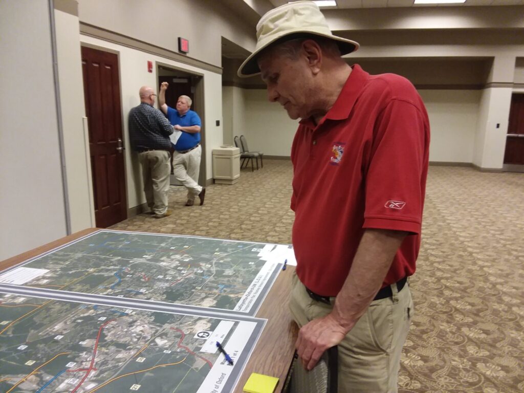
Vernon Shelton of Taylor looks over a map at a public review of the LOU Transportation Master Plan Thursday at the Oxford Conference Center.
Photo by Alyssa Schnugg
The new proposed LOU Transportation Plan in its entirety is a 287-page document. However, one yellow line drawn on the suggested new road project map has some Oxford citizens, and officials, ready to fight against its approval unless removed.
On Thursday, representatives from the Waggoner Engineering firm, jointly hired to develop the master plan by Oxford, Lafayette County and University of Mississippi leaders last year, presented copies of the proposed Master Plan with blown-up maps during a public meeting at the Oxford Conference Center.
LOU residents were invited to browse the plan and maps and make any last minute suggestions before the plan goes before each board for approval over the coming weeks.

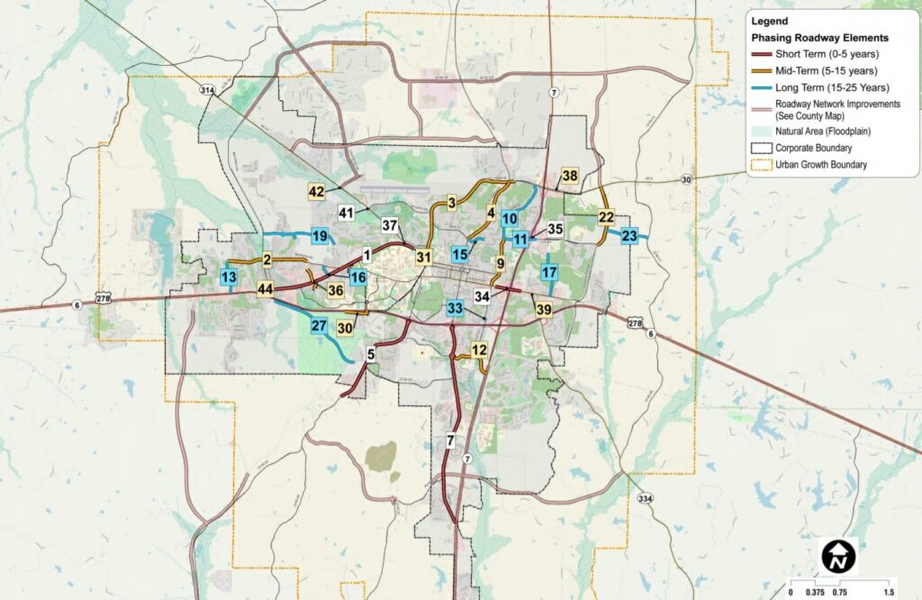
A proposed future road, No. 27 on the above map, has some Oxford residents, and officials, concerned for the South Campus Rail Trail.
The proposed road would begin at County Road 326, which is currently a short, gravel road off Old Taylor Road, and connect Old Taylor Road to Highway 6 near the Royal Oaks subdivision. The concern for residents Gail Gelbard and Vernon Shelton is that the road would cross over the South Campus Rail Trail.
“I am totally opposed to anything that would cross the trail,” Shelton said at the meeting.
Gelbard said the trail plays a “unique role” in the LOU community.
“Half of us will move from Oxford if we lose the trails,” she said. “The South Campus Rail Trail and the extensive network of hiking/biking trails adjacent to it are a treasure that brings together the university, Oxford, and Lafayette County residents for opportunities available nowhere else in Oxford. The trails provide an ever-changing panorama: students running together, families taking discovery walks to find wildflowers and salamanders near the ponds, ROTC units training, Campus Recreation leading outdoors activities, city employees arriving after work to lower their stress levels in a place free of traffic, fumes, and concrete.”
Alderman Janice Antonow who also attended Thursday’s meeting said she will not vote to approve the Master Plan if that proposed road is not removed from the plan.
Eric Jefferson, senior planner with Waggoner, said the goal of Thursday’s meeting was to gather any input from the community to present to each board.
“As each board considers approving the plan there will be more opportunities for the public to participate,” he said.
The Master Plan’s goals including creating a transportation system that is accessible, using current resources and maintaining the integrity of existing neighborhoods. Much of the data was compiled from previous studies, like the Vision 2037 plan for Oxford, the Lafayette County Comprehensive Plan, the Downtown Parking Study and the UM Master Plan.
Some of the area’s most problematic roads and highways are under the umbrella of the Mississippi Department of Transportation, like Highway 7 and the University Avenue and Highway 7 interchange. MDOT has said plans to widen Highway 7 to a four-lane highway have been stalled due to lack of funding.
Some of the recommendations to improve the roads that can be done locally, like West Jackson Avenue, including building raised medians and more bike lanes to help slow down traffic and provide space for pedestrians and bicyclists to travel more safely, encouraging less traffic on the roads, and improvements to the area’s bus system by creating more attractive shelters and synchronizing traffic signals to allow buses to travel more proficiently and keep on schedule.
Don Feitel, chairman of the Pathways Commission, said his board members reviewed the proposed Master Plan two weeks ago and have made several comments and suggestions to the consultants and city leaders.
“A lot of our thoughts focused on a lot of the smaller projects that were discussed,” Don said. “Including some things that can be done with paint or sidewalk design that are more affordable for the city.”
Looking over the suggested improvements to West Jackson Avenue, which includes several versions of how adding a pedestrian and bike path would look, Feitel said any change would be an improvement.
“What’s there now is not ideal by any means,” he said. “Being able to add something, especially, as you get closer to the university and get people from College Hill. Anytime you can get someone onto campus who isn’t driving a car, that’s less parking spaces that needed.”
The Master Plan lists the area’s most dangerous roads. The intersection that has had the most wrecks from 2013-2017 is the Highway 6 and Thacker Heights Drive with 135 crashes. The intersection of Highway 6/West Jackson Avenue was No. 2 with 101 crashes. The plan offers recommended improvements to several of the top crash intersections which include additional traffic signals, stop signs or adding turning lanes.

Jefferson said the plan also includes information on how to work toward receiving federal and state funds, as well as using more “creative” funding like involving developers in the development of new roads or improving existing roads.
Some of the suggested improvements were considered short-term fixes and others mid- to long-term fixes.
The entire Master Plan is available to view on the city’s website.


