

By Alyssa Schnugg
News editor
UPDATE: The NOAA Weather Radio transmitter in Oxford has been repaired, according to the NWS
Lafayette County could see some severe thunderstorms Friday as another storm system makes its way into the Mid-South.
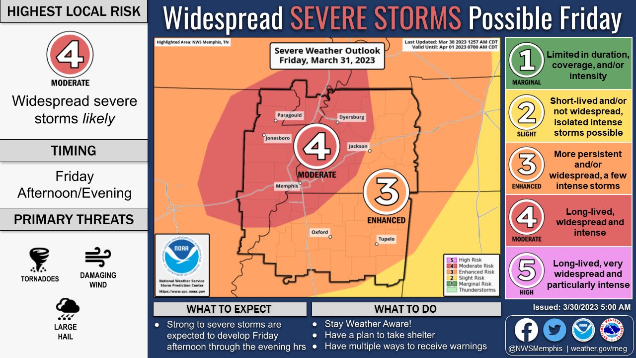
On the National Weather Service’s Severe Weather Risk 1 to 5 scale, Oxford is currently listed as being a 3, or having an Enhanced Risk, for severe weather Friday.
This storm system comes one week after several tornadoes ripped through parts of Mississippi last week, killing 25 people.
The storms will begin to roll into Lafayette County early Friday morning and continue throughout the day; however, the more severe storms are expected late afternoon into Friday night.

The NWS issued a Wind Advisory for Lafayette County from 7 a.m. Friday through 1 a.m. on Saturday. Winds are expected to be around 20-25 mph with gusts up to 40 mph possible as the front moves into the area.
The area just north of Lafayette County is rated a 4, or Moderate Risk for severe weather. As conditions could change, the NWS urges residents under the Enhanced Risk to stay tuned for updates and remain “weather aware.”
Oxford residents should not rely on their NOAA Weather Radios as the NWS has reported that the Weather Radio transmitter in Oxford is currently down.
Visit CodeRed (Lafayette or Oxford residents) or Nixle (city of Oxford residents) to sign up for weather and emergency notifications.
