Richie Burnette was a little lost. Along with Neilson’s Department Store Owner Will Lewis, Burnette—a former banker and commercial real estate broker, and longtime musician—was traversing backroads near his home of Oxford in search of the site of a Civil War-era encampment.
After studying 19th-century maps, Burnette and Lewis knew roughly where the encampment, which at one time housed over 10,000 Union troops, had been. But even with the historical map—plus an iPhone’s GPS feature—locating the former camp was no easy task.

Burnette looked over at Lewis and said, “Wouldn’t it be neat if we could be looking at that historic map on top of the current one? Then we’d know right where to go.”
While they eventually did locate the site, the idea of stacking maps from different eras and the discussion that ensued led to something even bigger: the Oxford-Lafayette County Heritage Foundation’s Historic Maps Project. Launched this September, the project is a public history resource that collects nearly two dozen digitized maps of Oxford and Lafayette County dating back to the 1830s into an accessible online platform.
It’s the first real foray of OLCHF—a nonprofit which has preserved and stewarded brick-and-mortar historic sites around Oxford and Lafayette County, including the Burns Belfry church and L. Q. C. Lamar House—into the digital humanities.
Burnette, president of OLCHF, worked closely on the project with Lewis and Jim Pryor, who serves as the organization’s treasurer, and Mark Levy, who helped them navigate the software used to set up the maps. Bill Freeman, treasurer of the Lafayette County Historical and Genealogical Society, joined the team, bringing another layer of special experience and perspective to the team. Freeman said the Maps Project will be invaluable to his organization’s work.
“We see people come in with a family Bible or box full of photos, and now we have a way to preserve and capture that to share with everyone,” he said.
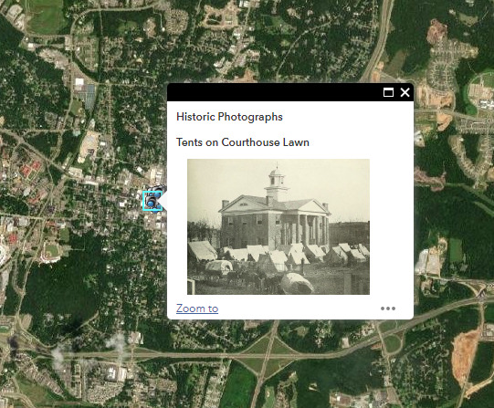
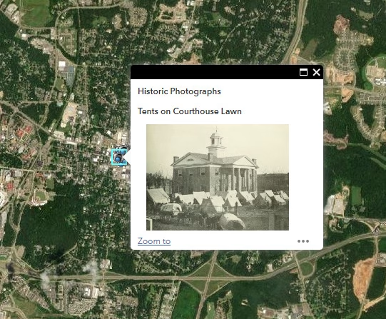
While hosted on OLCHF’s site, the project and its collection of maps are housed on ArcGIS, a digital mapping software platform. This allows website visitors to overlay historic maps with current satellite imagery and view geotagged photos to digitally explore Lafayette County’s past and present.
The Maps Project essentially functions as a digital museum of Oxford and Lafayette County history, allowing historians, genealogists and curious people of all stripes to explore local history in a single, convenient location online.
An academic historian, for example, can use the geotagged historic maps to get a sense of where events took place. Then, on a research trip to Oxford, they could use the maps overlayed with contemporary satellite images to trace the paths on their own.
Despite its idyllic locale, Lafayette County has played a critical role in American and Southern history, which makes the Maps Project useful to researchers across the United States and even internationally studying subjects from the Civil War and Civil Rights Movement to American literary and culture history.
“What started out from just riding around on a Sunday afternoon trying to find a site now means that anyone around the world can access this resource and research our local history,” Burnette said.
On a more personal level, imagine that someone digging in their attic uncovers Depression-era photos of their family’s ancestral home. If they knew where this property was, they could upload the photos and location information, so any user exploring the map could see what that parcel of Lafayette County looked like in the 1930s.
“The Maps Project provides an opportunity to tag historic items, photos and maps on an online database that the public can contribute to,” Pryor said. “We’re excited to take this next step toward a unique, digital history museum.”
Describing the Maps Project, Burnette likened it to a Christmas tree, onto which more and more ornaments—like historic photographs or land deeds—can be added as additional contributions are made. The group encourages the public to submit archival items, which can be done easily on their new website.
Burnette, Pryor and Lewis are all longtime Oxford residents who wanted to ensure these important maps, photographs and documents wouldn’t disappear.
“It’s rewarding to share this project with the public,” Lewis said. “I was worried that we would lose all of this to time, but this project allows us to forever preserve the history of the area.”
To explore the Historic Maps Project or learn more about OLCHF, visit their new website at oxfordmshistory.com. The group plans to be able to accept submissions from site visitors after the first of the year.
Courtesy of Red Window Communications

