Featured
Enhanced Risk for Severe Weather Wednesday Afternoon for Oxford
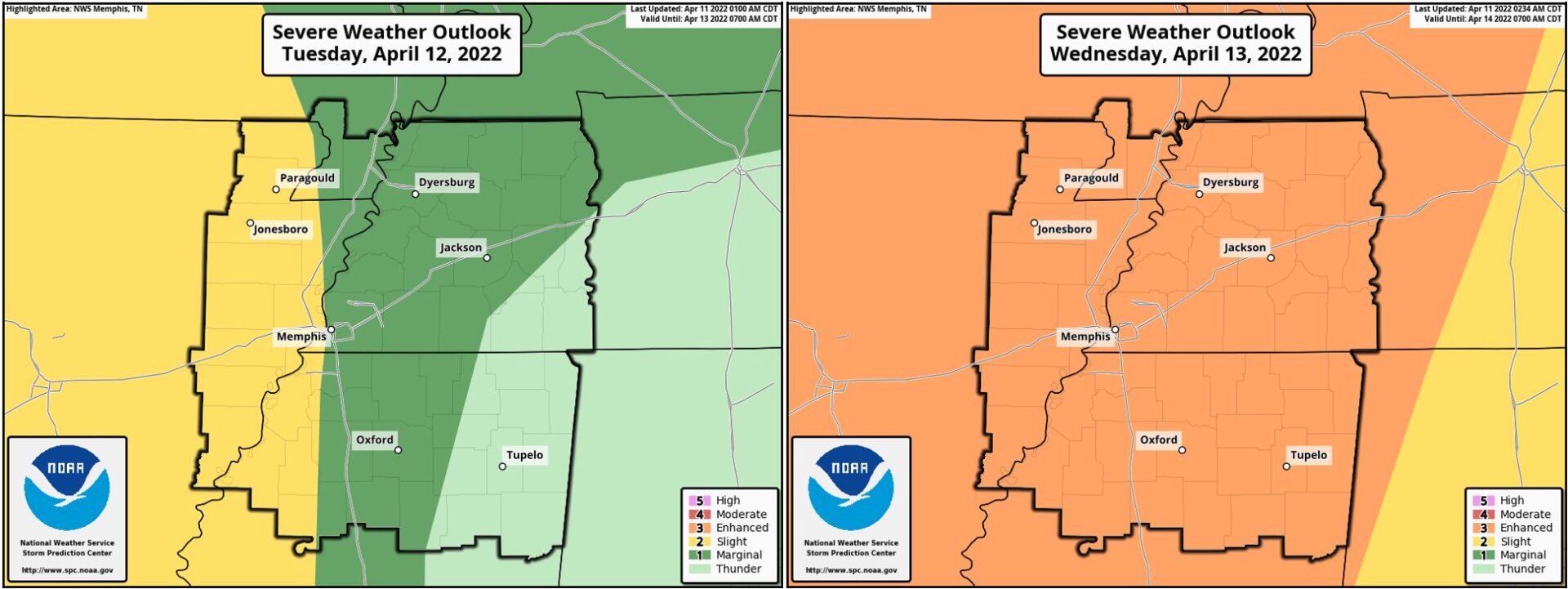
Lafayette County currently has an Enhanced Risk for severe weather Wednesday afternoon.

By Alyssa Schnugg
News editor
alyssa.schnugg@hottytoddy.com

Storms have moved into Lafayette County this morning bringing rain and thunder; however, there is little risk for severe weather today, according to the National Weather Service.
That is expected to change Wednesday.
Rain and isolated thunderstorms could continue throughout the day today and into the evening hours with the high temperature reaching about 76 degrees and a low tonight of 67 degrees.
There is expected to be a small break from the rain on Tuesday with only a 20 percent chance of showers forecasted for the day. Winds could range between 10 to 15 mph as an upper-level disturbance moves into the area.
Heavy rains and thunderstorms are expected to begin around 2 a.m. on Wednesday and continue throughout the day.
Lafayette County currently has an Enhanced Risk for severe weather Wednesday afternoon. That is a 3 on a scale of 1 to 5, with 1 being low risk and 5 being a high risk for severe weather.
Some of the storms after 2 p.m. Wednesday could be severe bringing hail, thunder and lightning, damaging winds and a chance of tornadoes.
Heavy rains today and Tuesday could increase the risk of flooding from the storms on Wednesday.
The severe storms could continue into the early morning hours on Thursday; however, skies are expected to clear Thursday morning leaving the rest of the day under sunny skies with a high of 72 degrees.
Hotty Toddy News will continue to monitor the weather and post updates on our website, Facebook and Twitter.


