Headlines
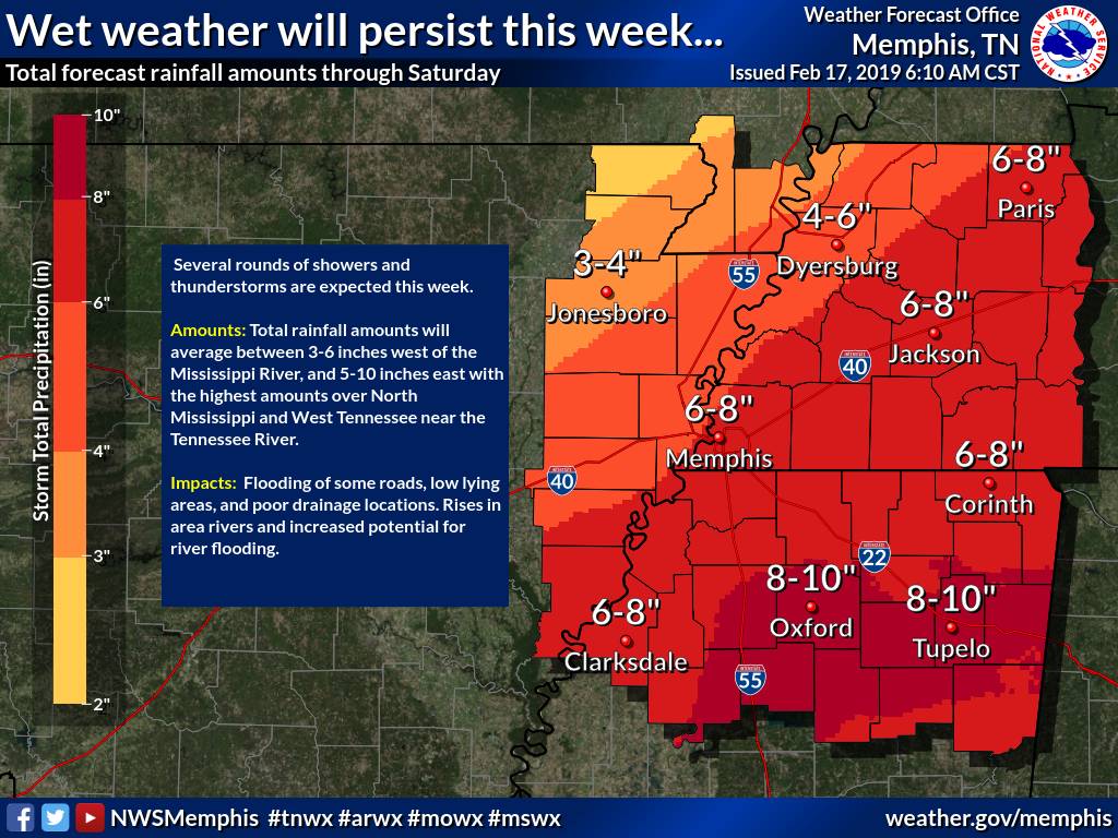
Oxford Could See 8-10 Inches of Rain This Week
By Alyssa Schnugg
News Editor
alyssa.schnugg@hottytoddy.com

From the Nation Weather Service Memphis
**UPDATE: The National Weather Service has issued a Flash Flood Watch starting Tuesday afternoon and running through Thursday.
Multiple rounds of rain will soak north Mississippi this week and into the weekend, with Oxford possibly seeing 8 to 10 inches of rain during what has already been a wet winter.
Several periods of heavy rainfall are expected, especially Tuesday and Tuesday night, and again for Thursday through Saturday as a series of upper-level disturbances move across the Lower Mississippi Valley, according to the National Weather Service.
The forecast rain amounts combined with an already saturated ground may lead to flooding of some roads, low lying areas and other poor drainage locations.
Highs will fluctuate with an expected high Tuesday of 49 degrees and a high for Wednesday at 63 degrees. However, the lows are expected to rain in the mid-40s throughout the week.
Early forecasts for Oxford show mostly sunny skies for Sunday.
Some river gauges in the mid-Mississippi Valley are already in minor or moderate flood from heavy rain earlier this month.
As always, if you are in an automobile and encounter a flooded roadway, do not attempt to drive through floodwaters. If you live a flood-prone location, be sure to stay informed this week on the impacts from any rising rivers or streams.


