Headlines
National Weather Service Predicts Possible Tornadoes in Mid-South, Including North Mississippi
The National Weather Service (NWS, based in Memphis, issued a special weather statement for the Mid-South, including north Mississippi, at 6:29 a.m., saying the record warmth expected today will create a “very unstable atmosphere” thus “conducive for the development of severe thunderstorms across the Mid-South through tonight.”
NWS said on its website: “Tornadoes… some of which may become strong along with large hail and damaging winds will be possible with thunderstorms that reach severe limits. Residents of the Mid-South and travelers coming through the area for the Christmas holiday are strongly urged to remain weather aware through tonight and be prepared to take appropriate safety precautions if severe weather threatens your location.”
NWS in Memphis also posted on its Facebook page, saying, “the severe risk will be the greatest this afternoon and evening.”
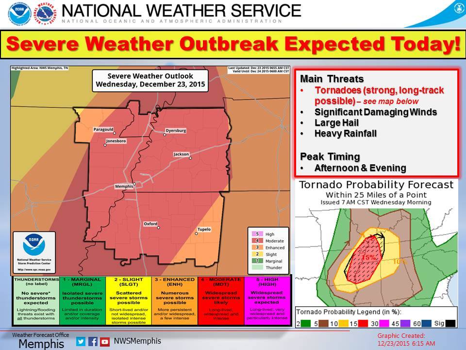
According to its graphic, much of north Mississippi, Oxford included, is in the red zone meaning widespread severe storms are likely. The main threats are possibly strong, long-track tornadoes, significant damaging winds, large hail and heavy rainfall.
Exercise caution, have multiple sources of weather information, and travel safely.
Callie Daniels Bryant is the senior managing editor at HottyToddy.com. She can be reached at callie.daniels@hottytoddy.com.
Follow HottyToddy.com on Instagram and Twitter @hottytoddynews. Like its Facebook page: If You Love Oxford and Ole Miss…


