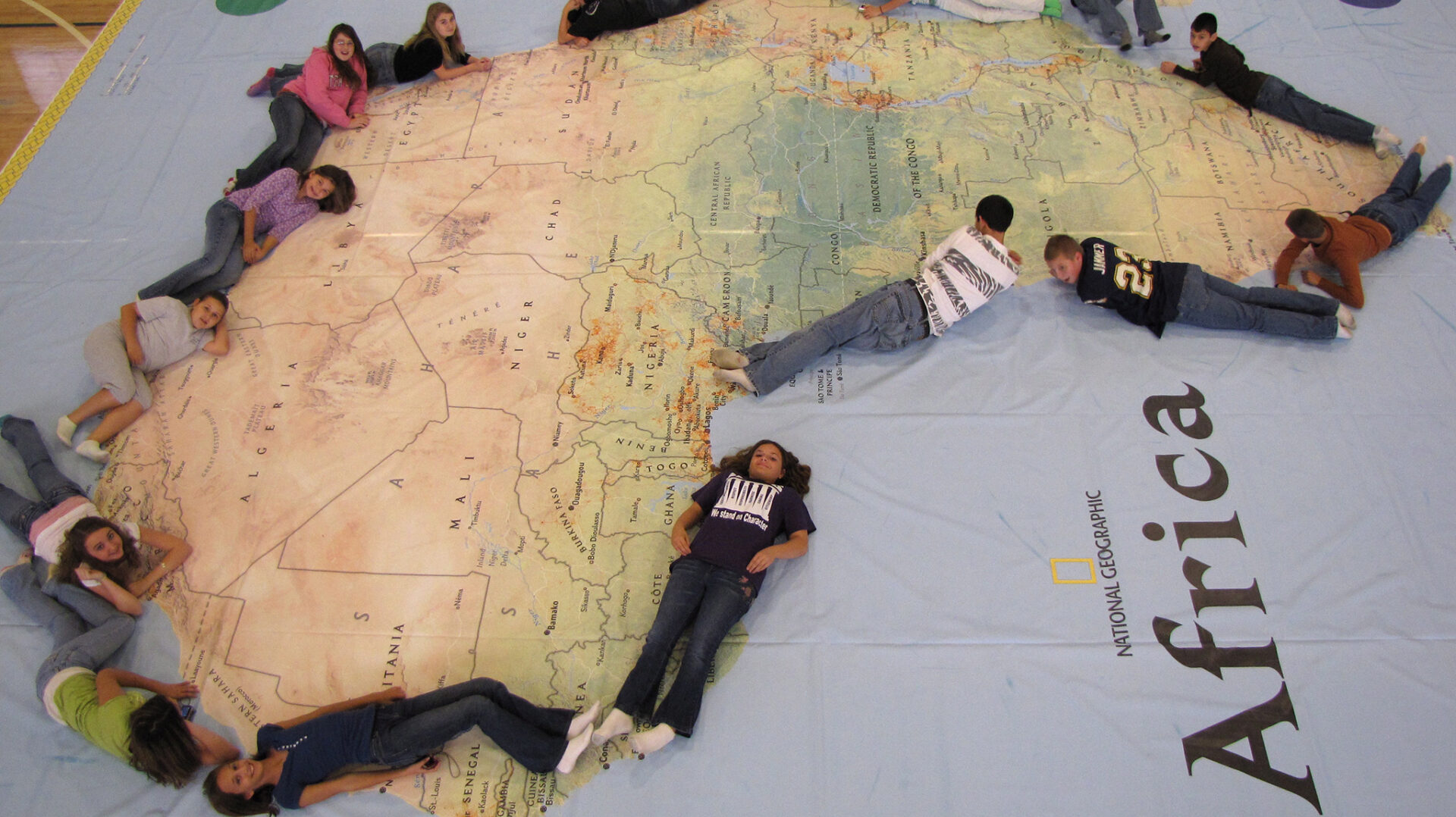
Photo courtesy of Paul Schoenike
The Mississippi Geographic Alliance at the University of Mississippi is bringing the world’s largest map of Africa to Oxford, among other locations, this month, giving students a chance to explore the diverse geography of the continent on a 35-by-26-foot “geo game board.”
The map, designed for students in grades K-8, has a brightly colored, smooth vinyl surface that illustrates Africa’s oceans, seas, rivers, mountains, countries and capitals. The map has a trunk full of accessories, including interactive activities, props and photo cards, to teach students about the physical characteristics of the continent as well as its rich history, wildlife and cultures.
Working in teams, students will mark the equator with ropes to learn about climate and latitude. A relay race will help them learn all the countries. Scavenger hunts and safaris will introduce them to the continent’s famed wildlife and varied environments. It will be available to students at several locations across Mississippi.
“Getting students on the giant map is a wonderful way to get them excited about the world around them,” Carley Lovorn, assistant director of the Mississippi Geographic Alliance at UM. “The sheer size of the map engages the students and while they are having fun, they’re also improving their geographic, mapping and spatial thinking skills.
The map will be at Oxford Elementary School during the day Feb. 23 for students, and the school will have an event for the public from 5 to 7 p.m. The map moves to Oxford Middle School the next day, and there’s also a public event from 6 to 8 p.m. Lafayette County Schools will host the map team Feb. 26 and 27. Lafayette County Schools will have a public event Feb. 26, but the time has not been set.
During February, the Mississippi Geographic Alliance and its partners, including multiple school districts, the Mississippi Museum of Natural Science and the schools of education at UM, Mississippi State University and the University of Southern Mississippi, will bring the map to several counties.
The Mississippi Geographic Alliance works to strengthen geographic literacy in the state. As part of the nationwide network of state alliances sponsored by the National Geographic Society, MGA uses workshops, online resources and other programs to help educators prepare students to embrace a diverse world, succeed in the global economy and steward the planet’s resources.
The map was first featured as a standard pull-out map in the September 2005 issue of National Geographic. National Geographic’s map division enlarged the map – the biggest ever created by the National Geographic Society – for educational tours through National Geographic Live.
Since the introduction of the original Africa map in 2006, the program has expanded to include maps of Asia, North America, South America, Europe and the Pacific Ocean. Each is rented to schools and other hosts with an assortment of activities. This school year, hundreds of thousands of students will interact with these maps. Besides school venues, the maps appear at museums, festivals, fairs and corporate and educational conferences.
The maps reinforce National Geographic’s commitment to increasing geo-literacy through teacher professional development, K-12 curriculum, live events and academic competitions. “Children have a whole new perspective on Africa after they’ve walked on this map,” said Dan Beaupré, director of education partnerships for National Geographic Live. “The hands- and feet-on experience brings the geography of Africa to life in a meaningful way and helps the students understand the connections between people and places.”
Courtesy of the Ole Miss News Desk
